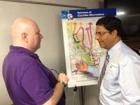
The Nevada Department of Transportation explained several route options for the proposed Interstate 11 project through Southern Nevada at a public meeting Thursday, Oct. 17, 2013, at NDOT's district offices.
Sun coverage
- More Sun political stories
- More Sun transportation stories
- Hey governor, please allow us 15 miles of toll-free interstate down here
- Las Vegas to Phoenix interstate, seen as a ‘game-changer,’ is step closer to reality
- Mayor: Proposed Interstate 11 could be commercial boon for Las Vegas
- Henderson officials voice support for proposed interstate
- Experts say developing new freeway vital to Southern Nevada
- After I-15 work, freeway to Phoenix will become focus
- Engineering marvel taking shape near Hoover Dam
- Boulder City Council endorses Vegas-to-Phoenix interstate
- Freeway to Phoenix gains traction with bridge work
Most of the public discussion about the proposed Interstate 11 project has involved the route between Phoenix and Hoover Dam and the proposed bypass of Boulder City.
But on Thursday, representatives of the Nevada Department of Transportation focused in a public meeting on the portion that would affect most Southern Nevada residents — how I-11 would pass through Las Vegas and continue to Northern Nevada.
Sondra Rosenberg, project manager for Nevada's portion of the I-11 plan, said 11 prospective route alternatives through the Las Vegas Valley have been whittled to five and will go forward for further study and review by NDOT engineers.
Some of the routes use existing highways; others have land ownership constraints and environmental concerns.
"Each route went through a series of evaluations and the ones that scored highest will get further review and consideration," Rosenberg told a group of about 40 people who crowded into a training room at NDOT's Las Vegas district center.
The study also considered highway corridors that could double as passenger and freight rail lines and utility transmission lines.
It was the fifth of five meetings in Arizona and Nevada over the past two weeks.
Rosenberg explained that while using existing highways for the I-11 route would lower costs, it could also lead to congestion problems as more and more transportation companies look to I-11 as an alternative route for shipping goods between Mexico and Canada.
Existing north-south routes Interstate 5 and Interstate 15 are already becoming congested.
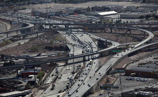
In public comment, several attending the meeting warned that using existing highways would result in more traffic through the Spaghetti Bowl, the intersection of I-15 and U.S. 95.
Another part of the decision process is determining the northern direction of I-11. Rosenberg said there's overwhelming support in Northern Nevada to use the U.S. 95 corridor which runs through Beatty and Tonopah toward Reno and Carson City. The other alternative is U.S. 93 through Alamo, Caliente and Ely toward Elko. Rosenberg said the big advantage to using the U.S. 95 corridor is that it would connect the state's two largest population centers.
The five routes under consideration:
• Listed as Alternative AA, the route from Boulder City would use existing U.S. 95 to the Spaghetti Bowl, then north on I-15 to U.S. 93.
• Listed as Alternative Z, the route from Boulder City would use existing U.S. 95 through the Spaghetti Bowl toward Indian Springs.
• Listed as Alternative QQ, the route from Boulder City would require construction of a new north-south highway east of Frenchman Mountain, curving west north of Nellis AFB and connecting with the 215 Beltway.
• Listed as Alternative BB, the route from Boulder City would be the same as Alternative QQ to an intersection with I-15, then west on a new highway at the base of the Sheep Range, known as the Sheep Mountain Parkway, to U.S. 95.
• Listed as Alternative Y, the route from Boulder City would go north on U.S. 95 to the 215 Beltway to near Ann Road where a new highway would be built farther north to connect with U.S. 95.
Rosenberg said some of the alternatives under consideration would require traversing land currently designated as Nellis AFB property.
NDOT is expected to bring its next update to the public in June.